By Josh Chang
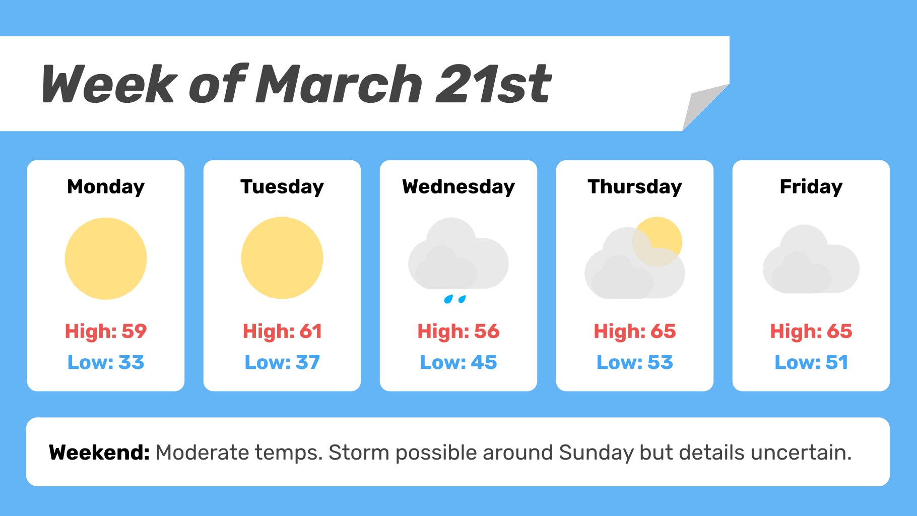
With the vernal equinox behind us, this week will mark the official start of spring. With above average temperatures, it will certainly feel that way. The week will begin with a couple of days of ample sunshine and low winds before more clouds begin to move in mid-week as two seperate low pressure systems pass well to our north. Weak trailing cold fronts from those systems could possibly bring a few showers later Wednesday and sometime Friday.
Monday
High pressure will bring excellent weather Monday. Ample sunshine, low winds, and dry air. A comfortable high around 60.
The dry air from the high pressure will allow nighttime temps to dip substantially Monday night, likely to around freezing.
Tuesday
Tuesday’s weather will be very similar to Monday if not a few degrees warmer, with a high in the low 60s expected.
Tuesday night low in the upper 30s.
Wednesday
More clouds will move in Wednesday as a strong low pressure system moves well to our north over Canada. A weak trailing cold front from that system could bring some rain in the afternoon or evening, but there is still some uncertainty here. A high in the mid- to upper 50s is expected.
Wednesday night low in the mid-40s.
Thursday
High temp Thursday in the 60s. Mostly cloudy skies are forecast. I cannot rule out a shower or two during the day, but not very likely.
Quite warm Thursday night, with a low in the low-50s.
Friday & Next Weekend
Warm and cloudy again Friday as a second low passes to the north. A high temp in the 60s or maybe even the low 70s. Some rain showers are certainly possible at some point, but I wouldn’t bet either way,
Similar comfortable temps are possible this weekend. Some sort of rain storm is showing up on a number of the models for around Sunday, but the timing and details of that event are still highly uncertain.