By Josh Chang
This is the first installment of a new weekly weather column.
On average, the coldest three months of the year in Irvington begin around December 10th and end around March 10th. This year is looking like it will be no exception. After a relentless February, springlike warmth is finally coming starting Tuesday, at least for a few days. Except for potentially a few showers during the day Friday, this week will be dry and beautiful.
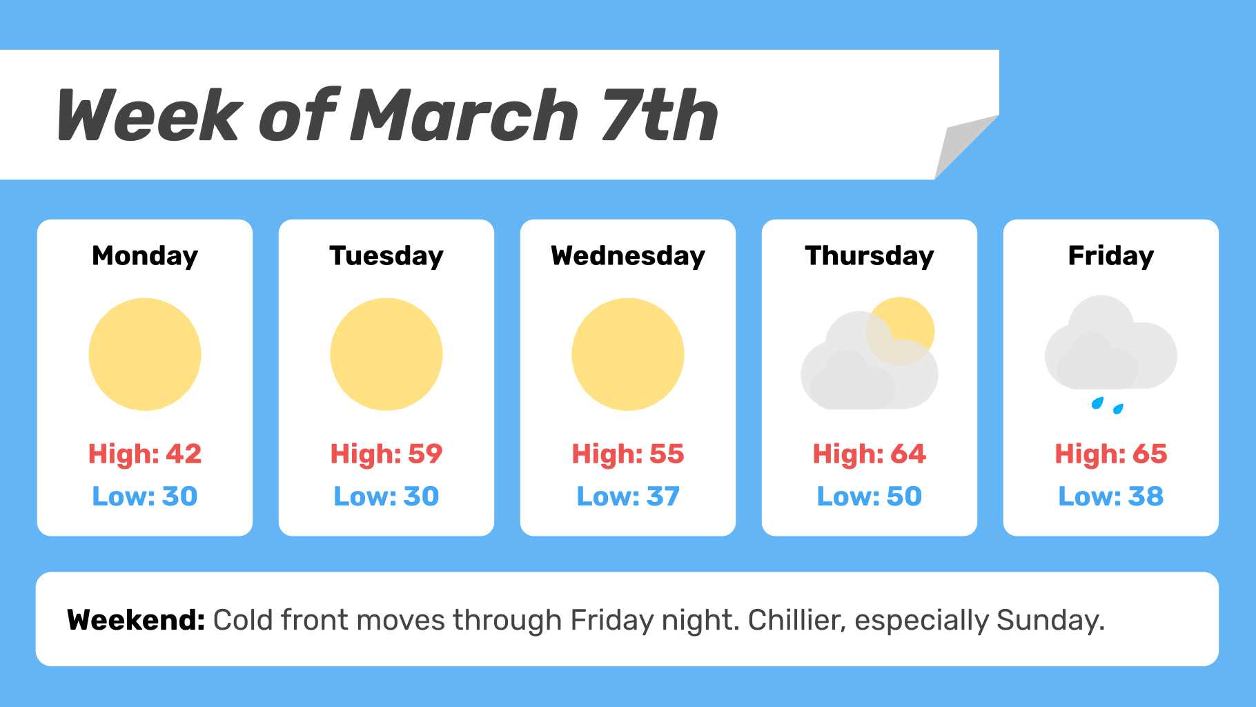
Monday
A lingering cold air mass over the Northeast means Monday will be sunny but cold. Morning temps in the low 20s and a high around 40. It will also be breezy, so bundle up.
A strong warm front will move through overnight, bringing clouds. Low temp around freezing.
Tuesday
Tuesday will feel like spring. The weather will be noticeably excellent, with plenty of sunshine and a high in the upper 50s.
Tuesday night low temp will be in the low 30s.
Wednesday
Wednesday will be largely the same as Tuesday, if not even more sunny. May be a couple of degrees colder than Tuesday, with a high temp in the mid-50s.
Mostly cloudy overnight, with a low in the mid- to upper 30s.
Thursday
Thursday will be even warmer but with more clouds, especially in the morning. A high temp up in the low to mid-60s is expected.
The warmth will persist overnight with a low in the low 50s. A few showers are possible.
Friday & Next Weekend
Friday will potentially be the last day of spring-like warmth, but far more dreary than earlier in the week. Mostly cloudy, with some rain showers during the day as a cold front approaches the region. A high in the low to mid-60s again.
The cold front will likely finish passing through the region around Friday night or Saturday, with substantially chillier temps possible, especially Sunday. Confidence in the forecast is inherently low this far out.